Xav & Jul
Français

Back to Geoloweb.ch

Print...

Photos - serie 1

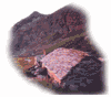
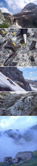
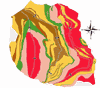
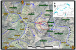
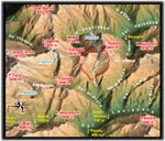
Some maps of the Alpe Larecc and his surrounding area...

Tectonic map

Geological and tectonic maps of Val Lareccio
(result of our work)

© J. Allaz & X. Maeder - UNIL (Earth Sciences), 2003

Geological map Tectonic map
GIF (785 ko) GIF (160 ko)
  (without topography)

Extract of geographic map (152 ko)

(from swiss topographical map n°1272 - 1:25'000, 1998)

Carte géographique

Carte géographique 3D

3D Bloc-diagram of Campo Tencia's area

(modified from the Atlas of Switzerland, 1999, Institute of Cartography, ETH Zürich)

Low resolution (95 ko)
High resolution (338 ko)

Map of Val Lareccio's named places (28 ko)

(after swiss topographical map n°44 "Monte Zucchero" - 1:10'000, 1977)

Carte des Lieux-dits

Photo - serie 2

Uni Lausanne || Geology 2003-2005 © Xavier Maeder & Julien Allaz Created: 10th May 2003
Last update: 28th December 2023